


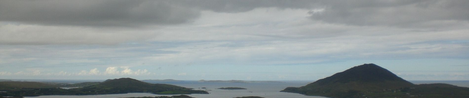
Upper Diamond Hill walk

SityTrail - itinéraires balisés pédestres
Tous les sentiers balisés d’Europe GUIDE+
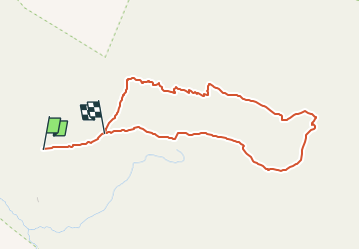

Length
3.7 km

Max alt
424 m

Uphill gradient
264 m
Km-Effort
7.1 km

Min alt
155 m

Downhill gradient
227 m
Boucle
No

Signpost
Creation date :
2025-02-06 12:46:19.553
Updated on :
2025-02-06 12:46:19.553
1h36
Difficulty : Easy

FREE GPS app for hiking
 SityTrail
IGN / Geographical institutes
SityTrail Plus
The world is yours!
About
Trail On foot of 3.7 km to be discovered at Unknown, County Galway, Conamara Municipal District. This trail is proposed by SityTrail - itinéraires balisés pédestres.
Description
Trail created by National Parks and Wildlife Service.
Photos

Positioning
Country:
Ireland
Region :
Unknown
Department/Province :
County Galway
Municipality :
Conamara Municipal District
Location:
Ballynakill Electoral Division
Start:(Dec)
Start:(UTM)
438100 ; 5933446 (29U) N.
Comments